
Zero In on Vermont Spans
Switch on the Covered Bridge filter to pinpoint historic spans across Bennington, Woodstock, Stowe, and the Northeast Kingdom without commercial distractions.
Vermont's covered bridge country is the cluster of 19th-century timber spans and quiet backroads threading the Green Mountains, from Bennington County's trio of Town lattice bridges to the river bends of Route 100 and the Mad River Valley. Vermont has more covered bridges per square mile than any other U.S. state. WanderWay turns every weekend drive into an authentic heritage tour.
Free to try · One-time purchase · Zero subscriptions · Zero ads · No tracking
By Derek Boyer, WanderWay's founder & developer · Published · Updated
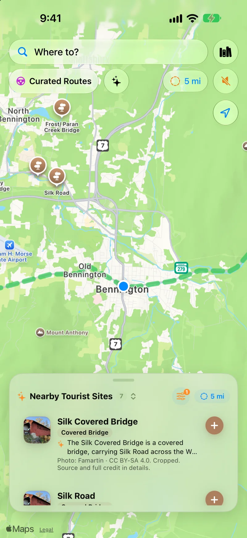
Silk Covered Bridge, Burt Henry, and Murphy Road in a tight 5-mile country loop. Complete with construction notes and Wikipedia photography.
Green Mountain Touring
Say goodbye to interstate reroutes. WanderWay keeps you on the backroads where New England heritage thrives.
Switch on the Covered Bridge filter to pinpoint historic spans across Bennington, Woodstock, Stowe, and the Northeast Kingdom without commercial distractions.
As you approach bridges like Silk Road or Chiselville, WanderWay announces their presence and bearing ("Ahead on your left...") so you can enjoy the foliage safely.
Cell reception can drop out in Vermont's mountain hollows. Download the places along your route before leaving town, so their descriptions stay on your iPhone. Maps and routing may still need a connection, so set up your route before you lose signal.
Open Curated Routes, choose an afternoon timeframe, select 'Prefer Scenic Backroads', and let WanderWay stitch together quiet gravel country roads and historic bridges back to your inn or driveway.
Know Before You Go
Bennington County's Burt Henry Covered Bridge, built about 1840, was listed in 1973 as the county's oldest covered bridge. It is one of three historic Town lattice bridges on a two-mile stretch of the Walloomsac River.
All three cross the Walloomsac River within two miles of each other, all are Town lattice truss bridges, and all have been listed on the National Register of Historic Places since 1973: Burt Henry (about 1840, rebuilt in 1989), Paper Mill Village (1889, rebuilt in 2000), and Silk (probably 1840).
Vermont had more than 700 covered bridges in the 19th century. The 1927 flood destroyed about 100 of them, and by 1996 only 106 were left, according to the state's Division for Historic Preservation.
Color usually starts at higher elevations and sweeps down into the valleys. Vermont Tourism says foliage is popping in the last week of September and first week of October, and by mid- to late October the peaks are bare while the valleys are still bright. Route 100 is a popular foliage route, so a weekday drive means lighter traffic at the bridges themselves.
Download the places along your route before you leave town to keep bridge descriptions and spoken directional narration of those places on your iPhone through mountain hollows where cell coverage can drop out. Maps and routing may still need a connection, so set up your route before you lose signal.
Heritage
Vermont's builders covered their bridges because a roof keeps the timber trusses dry; without one, the state's Division for Historic Preservation notes, the trusses would fail in a few years, and the roof paid for itself. The state built more than 700 in the 19th century, and enough survived floods and replacement to leave it with more covered bridges per square mile than any other state.
Keep exploring: a national guide to covered bridge road trips, Pennsylvania's Lancaster County covered bridges, and Ohio's covered bridge counties.
Open Curated Routes, pick a loop or a drive to a destination, and choose how long you have, from 30 minutes to 5 hours. Turn on Prefer Scenic Backroads to stay off highways, or Favor US scenic byways to lean on designated byways. To make a planned trip more scenic, use the Faster or Prettier slider on the route card. Scenic adds up to a quarter more time for sights along the way and is free. Very scenic and Most scenic add more time and take backroads instead of highways; they’re part of WanderWay Unlock.
Yes, if the route is saved first. With Saved When You Start, WanderWay downloads the route as you set off, so the sights and their descriptions stay with you when signal drops. On cellular data, it asks before downloading. Live traffic, weather, and park alerts still need a connection.
Place details come from public sources such as Wikipedia, Wikimedia Commons, the National Register of Historic Places, and the National Park Service, so a small or newly reopened spot may be missing. Routing comes from Apple Maps, so check the park or state road agency before a long mountain or coastal drive. Watch the road, not the screen: stories are spoken so you can keep your eyes up.
Vermont FAQ
Common questions about exploring Vermont's scenic byways with WanderWay.
WanderWay features a dedicated Covered Bridge category filter powered by OpenStreetMap and National Register data. It surfaces historic spans like Bennington's Silk Covered Bridge, Paper Mill Village, and Burt Henry Bridge, announcing their approach with directional spoken voice audio.
Yes, for the places along your route. WanderWay lets you download the places and descriptions along your route to your iPhone, so voice narration of those places keeps going even in remote Green Mountain notches and river hollows. Maps and routing may still need a connection, so set up your route before you lose signal.
WanderWay is designed specifically for scenic touring. Its Curated Routes feature allows you to create custom 1- to 4-hour circular routes along Route 100 and rural mountain byways, bypassing interstates to prioritize foliage, covered bridges, and panoramic overlooks.
Ready for the Green Mountains?
Free to download with a free trial, then a one-time purchase. No ads, no subscriptions, and zero tracking. iPhone and Apple CarPlay on iOS 26 or later.
The bridge counts and history on this page come from these pages: