
Bypass Commercial Congestion
Enable 'Prefer Scenic Backroads' to steer clear of strip-mall gridlock. WanderWay routes you through scenic hollows, peaceful valley roads, and mountain spurs.
Great Smoky Mountains National Park is a 522,427-acre park straddling the Tennessee–North Carolina line and the most visited national park in the country, with more than 12 million recreational visits in 2024. Escape the commercial strip in Gatlinburg and Pigeon Forge and discover the park's quieter side: the historic pioneer cabins of Cades Cove, roaring mountain streams, and sweeping vistas on the Foothills Parkway. WanderWay narrates Tennessee’s natural wonder directly through your car speakers.
Free to try · One-time purchase · Zero subscriptions · Zero ads · No tracking
By Derek Boyer, WanderWay's founder & developer · Published · Updated
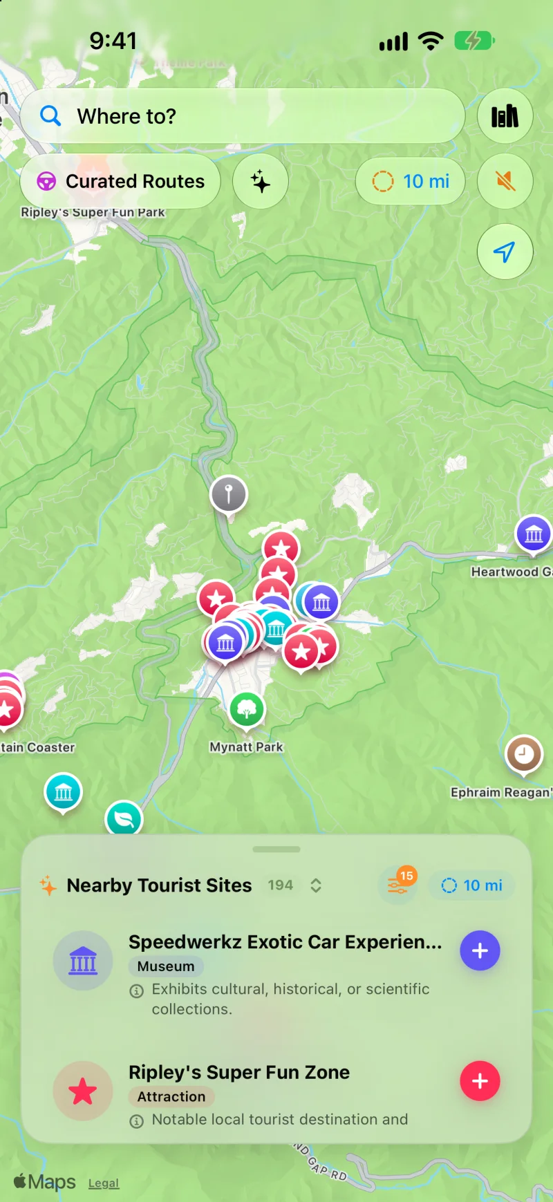
194 destinations mapped around Gatlinburg and Great Smoky Mountains National Park. Explore mountain coasters, pioneer museums, nature reserves, and panoramic gaps.
Smoky Mountains Features
Don't get stuck bumper-to-bumper on the Parkway. WanderWay guides you to the road trip spots that made the Smokies legendary.
Enable 'Prefer Scenic Backroads' to steer clear of strip-mall gridlock. WanderWay routes you through scenic hollows, peaceful valley roads, and mountain spurs.
The National Park Service says cellular coverage inside the park is very limited, and some areas have no service at all. Download the places along your route before you go, so their descriptions stay on your iPhone. Maps and routing may still need a connection, so set up your route before you lose signal.
Hear about historic log cabins, Cherokee heritage, and scenic cascade turnouts spoken directionally relative to your vehicle ("Ahead on your left...") so you never miss a stop.
Open Curated Routes, pick a 2-hour or 3-hour window, and let WanderWay create an automated loop that circles through mountain vistas and returns you straight back to your cabin or resort.
Know Before You Go
Almost. Cades Cove Loop Road is open sunrise to sunset daily, but it is closed to vehicles on Wednesdays, typically from May through September.
The loop passes three churches, a working gristmill, barns, and log houses restored from the 18th and 19th centuries. Traffic is heavy in summer and fall and on weekends all year, and the park says to allow at least two to four hours, so arrive early.
Newfound Gap Road (US 441), an All-American Road, crosses the park for 31 miles from Gatlinburg, Tennessee, to Cherokee, North Carolina. It tops out at Newfound Gap (5,046 feet) on the state line, the lowest drivable gap through the park.
Long known as Clingmans Dome, the peak officially reclaimed its Cherokee name, Kuwohi ("mulberry place"), in 2024. A steep half-mile paved trail leads to the observation tower at the top.
Toggle "Prefer Scenic Backroads" to route around the Gatlinburg and Pigeon Forge commercial corridor, and download the park corridor in advance, because cell coverage inside the park is very limited.
Beyond Cades Cove, the Roaring Fork Motor Nature Trail is a one-way loop near Gatlinburg: 5.5 miles of narrow, winding pavement past log cabins, gristmills, and waterfall trailheads. Buses, trailers, and motor homes are not allowed on it, and it closes for part of the year, so check the park's seasonal road status first. The park is also home to the densest black bear population in the country — biologists estimate around 1,900 bears, or roughly two per square mile — so WanderWay's directional cues matter as much for spotting wildlife turnouts safely as for finding the next overlook.
Beyond the Smokies
The same Blue Ridge chain continues north into Virginia, and WanderWay covers an entirely different kind of mountain driving on California's coast.
Keep exploring: Skyline Drive and Shenandoah National Park, and California's Big Sur coast on Highway 1.
Open Curated Routes, pick a loop or a drive to a destination, and choose how long you have, from 30 minutes to 5 hours. Turn on Prefer Scenic Backroads to stay off highways, or Favor US scenic byways to lean on designated byways. To make a planned trip more scenic, use the Faster or Prettier slider on the route card. Scenic adds up to a quarter more time for sights along the way and is free. Very scenic and Most scenic add more time and take backroads instead of highways; they’re part of WanderWay Unlock.
Yes, if the route is saved first. With Saved When You Start, WanderWay downloads the route as you set off, so the sights and their descriptions stay with you when signal drops. On cellular data, it asks before downloading. Live traffic, weather, and park alerts still need a connection.
Place details come from public sources such as Wikipedia, Wikimedia Commons, the National Register of Historic Places, and the National Park Service, so a small or newly reopened spot may be missing. Routing comes from Apple Maps, so check the park or state road agency before a long mountain or coastal drive. Watch the road, not the screen: stories are spoken so you can keep your eyes up.
Smoky Mountains FAQ
Common questions about exploring the Smokies with WanderWay.
WanderWay features a 'Prefer Scenic Backroads' routing engine that avoids congested multilane commercial strips, routing you along rural mountain passes, Foothills Parkway, and historic valley byways.
Yes. The National Park Service says cellular coverage in Great Smoky Mountains National Park is very limited. WanderWay lets you download the places and descriptions along your route ahead of time, so spoken alerts for those places can keep going without a signal. Maps and routing may still need a connection, so set up your route before you lose signal.
WanderWay reveals over 190 regional points of interest around Gatlinburg and the national park, including historic log cabins, 19th-century grist mills, scenic waterfall turnouts, mountain coaster trailheads, and panoramic ridge overlooks.
Explore the Mountains
Free to download with a free trial, then a one-time purchase. No ads, no subscriptions, and zero tracking. iPhone and Apple CarPlay on iOS 26 or later.
The road and park facts on this page come from these pages: