
Know Left vs. Right Turnouts
Overlooks in Shenandoah face either east toward the Piedmont or west across the Shenandoah Valley. WanderWay announces the side of the road before you arrive so you can maneuver safely.
Skyline Drive is the 105-mile scenic road that runs the length of Shenandoah National Park along the crest of the Blue Ridge Mountains, linking Front Royal in the north to Waynesboro in the south. The park counts more than 75 overlooks along the way, each facing either the Shenandoah Valley or the Piedmont. WanderWay tells you which side of the car to look, speaks directional alerts for scenic turnouts, and keeps the place descriptions you download when mountain signal fades.
Free to try · One-time purchase · Zero subscriptions · Zero ads · No tracking
By Derek Boyer, WanderWay's founder & developer · Published · Updated
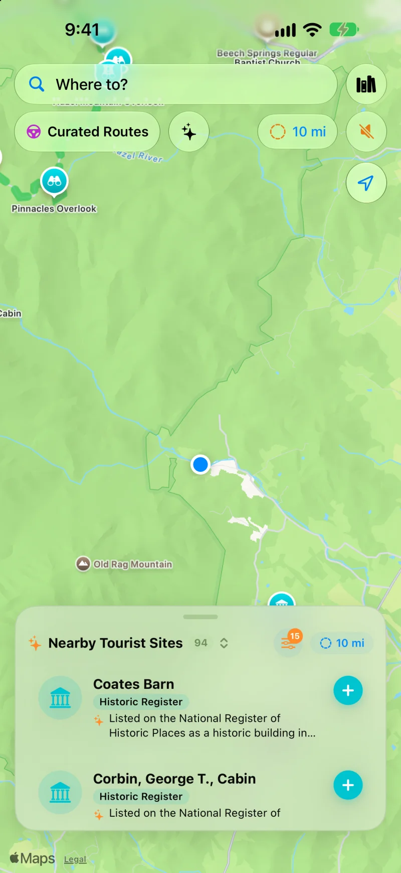
More than 75 overlooks line Skyline Drive. Viewpoint pins like Pinnacles Overlook mark the turnouts, and each place comes with a short description.
Ridge Touring Features
Standard commuter navigation treats Skyline Drive like a slow detour. WanderWay treats it like the main event.
Overlooks in Shenandoah face either east toward the Piedmont or west across the Shenandoah Valley. WanderWay announces the side of the road before you arrive so you can maneuver safely.
Cellular data is notoriously spotty along the Blue Ridge. Download the places along your route before you climb, and WanderWay keeps them and their descriptions on your iPhone. Maps and routing may still need a connection, so set up your route before you lose signal.
Discover the origins of Skyland, Big Meadows, Appalachian Trail crossings, and rustic stonework built by the CCC during the 1930s as you drive past them.
Keep your phone stowed away. WanderWay's CarPlay dashboard shows clear overlook badges and upcoming stops with large, high-contrast typography.
Know Before You Go
Only for bad weather. Skyline Drive stays open through the winter unless snow or ice closes it, and the park says crews can take several days to reopen it because of the cold. Check the park's SHENALERTS text service before a late-fall or winter drive.
Skyline Drive runs from Front Royal to Rockfish Gap near Waynesboro, with a 35 mph speed limit in most places. Driving it straight through takes about three hours on a clear day; the park says most people need at least three to four hours, with more than 75 overlooks along the way.
A private vehicle pass covers everyone in the car for seven consecutive days at any of the park's four entrance stations: Front Royal (mile 0), Thornton Gap (31.5), Swift Run Gap (65.5), and Rockfish Gap (104.6) at the Waynesboro end. The park is cashless, so pay by card.
Typical winter runs November through February. The ridge is usually 10 to 20°F colder than the lowlands, so rain in the valley can be ice and snow on the mountain, and crews can need several days to reopen the drive after a storm.
The park says cell coverage is not reliable in most of Shenandoah. Download the places along the park corridor before you climb out of Front Royal or Waynesboro to keep spoken overlook narration for those places going with zero signal. Maps and routing may still need a connection, so set up your route before you start.
Skyline Drive runs alongside 101 miles of the Appalachian Trail on its way through the park. The easiest waterfall detour is Dark Hollow Falls: a 1.4-mile round-trip hike with 440 feet of elevation gain, from a parking area at mile 50.7, roughly the midpoint of the drive. WanderWay flags the trailhead pull-off as you approach so you don't drive past one of the park's most traveled trails without knowing it's there.
Beyond Shenandoah
The Blue Ridge Mountains continue south past Shenandoah into the Great Smoky Mountains, while California offers its own kind of cliffside mountain driving on the opposite coast.
Keep exploring: Great Smoky Mountains scenic drives and Cades Cove, and California's Big Sur coast on Highway 1.
Open Curated Routes, pick a loop or a drive to a destination, and choose how long you have, from 30 minutes to 5 hours. Turn on Prefer Scenic Backroads to stay off highways, or Favor US scenic byways to lean on designated byways. To make a planned trip more scenic, use the Faster or Prettier slider on the route card. Scenic adds up to a quarter more time for sights along the way and is free. Very scenic and Most scenic add more time and take backroads instead of highways; they’re part of WanderWay Unlock.
Yes, if the route is saved first. With Saved When You Start, WanderWay downloads the route as you set off, so the sights and their descriptions stay with you when signal drops. On cellular data, it asks before downloading. Live traffic, weather, and park alerts still need a connection.
Place details come from public sources such as Wikipedia, Wikimedia Commons, the National Register of Historic Places, and the National Park Service, so a small or newly reopened spot may be missing. Routing comes from Apple Maps, so check the park or state road agency before a long mountain or coastal drive. Watch the road, not the screen: stories are spoken so you can keep your eyes up.
Skyline Drive FAQ
Common questions about navigating Shenandoah National Park with WanderWay.
Yes. WanderWay announces viewpoints and scenic pullouts directionally (e.g. 'Ahead on your right: Crescent Rock Overlook') so you know which side of the vehicle offers the valley panorama before you pass the turn-in.
Yes. Shenandoah's deep mountain crests often lack cellular coverage. WanderWay lets you download the places and descriptions along the park corridor in advance, so voice announcements for those places can keep going without a signal. Maps and routing may still need a connection, so set up your route before you lose signal.
Yes. WanderWay has a native Apple CarPlay interface that displays scenic turnouts and upcoming historic sites directly on your dashboard screen.
Drive the Blue Ridge
Free to download with a free trial, then a one-time purchase. No ads, no subscriptions, and zero tracking. iPhone and Apple CarPlay on iOS 26 or later.
The road and park facts on this page come from these pages: